Nan Walsh named to Virginia Lawyers Weekly’s Influential Women of Law 2019

Congratulations to our managing shareholder, Nan Walsh, who was named to Virginia Lawyers Weekly‘s Influential Women of Law 2019. Virginia Lawyers Media, the publisher of Virginia Lawyers Weekly, has announced the inaugural class of “Influential Women of Law.” This new awards program honors women attorneys and judges for their excellent work on behalf of their clients, their commitment to their communities, and their service to the profession.


Kathryn R. Taylor Joins Walsh Colucci

Kathy Taylor joins the firm as a zoning associate in the Arlington office. Prior to joining Walsh, Colucci, Lubeley & Walsh, she worked as an associate for ShounBach, where she gained substantial experience in family law serving clients in Northern Virginia. She represented clients on all issues surrounding divorce, such as division of marital property, custody, child support, and alimony as well as cases relating to protective orders, modifications, and show cause. Kathy is a graduate of George Mason University School of Law, where she was a member of the Civil Rights Law Journal. She also holds a bachelor’s degree in History from the University of Virginia. Outside of work, she enjoys spending time with her family and friends, running, as well as exploring new places and restaurants. Welcome, Kathy!

City of Fairfax Adopts Revised Zoning and Subdivision Ordinances

Representative Graphic
Source: City of Fairfax Zoning Ordinance

On July 12, the City of Fairfax City Council unanimously voted to adopt revised versions of the City’s Zoning and Subdivision Ordinances.

The adoption of the revised ordinances represents the culmination of an extensive, multi-year drafting and public engagement process designed to streamline and modernize the City’s zoning and subdivision regulations. During the public review process, City Staff and consultants held a series of community meetings and work sessions with the City Council, Planning Commission, and other boards and commissions to gather feedback and refine the proposed amendments.

Developed with input from community members, business representatives, and developers, the revised ordinances:

  • are reorganized into new, easy-to-use formats;
  •  streamline application review procedures;
  •  provide a more predictable set of land use regulations by increasing reliance on objective standards, rather than discretionary special approvals;
  •  eliminate confusing and outdated language;
  •  modify certain dimensional and use criteria for residential and nonresidential zoning districts;
  •  create a new “Commercial Urban” zoning district; and
  •  modernize signage regulations.

The new Zoning and Subdivision Ordinances will go into effect October 1. For more information, please visit the City of Fairfax Zoning Rewrite project webpage here, which includes links to the final adopted Zoning Ordinance and Subdivision Ordinance.

2400 Columbia Pike Approved for Development

Graphic representation of 2400 Columbia Pike
Source: WHA Architecture and Planning

On June 18, the Arlington County Board voted unanimously to approve a special exception use permit for a new mixed-use building at 2400 Columbia Pike, pursuant to the Columbia Pike Commercial Centers Form Based Code.

Located at the corner of Columbia Pike and South Barton Street, the site of the approved building is currently home to Rappahannock Coffee and other neighborhood retailers. Under the Form Based Code, the existing buildings on the site are designated as “historic façades.” Cathy Puskar assisted the firm’s client and its design team with developing a plan that incorporated the historic façades into the new building envelope and securing approval of the preservation plan by the Historic Affairs and Landmark Review Board.

The new six-story building will contain 105 market-rate residential units, approximately 14,700 square feet of ground floor retail, and two levels of below-grade parking. The unique architectural design of the building is specifically intended to accentuate the historic façades, which will be preserved, and to create a welcoming pedestrian environment. In combination with the Penrose Square and Siena Park developments across the street, the new building at 2400 Columbia Pike will contribute to a greatly enhanced walkable, mixed-use, urban corridor on the eastern end of Columbia Pike.

Cathy is currently representing additional Commercial Centers and Neighborhoods Form Based Code developments along Columbia Pike.


New Metro Station Paves Way for North Potomac Yard Development

Walsh, Colucci, Lubeley & Walsh is pleased to announce that Cathy Puskar and Amy Friedlander are representing The JBG Companies in their pursuit of approvals for the first phase of development in North Potomac Yard, which will coincide with the construction of the Potomac Yard Metrorail Station on the Yellow and Blue Lines. The new Metro Station will be located between the National Airport and Braddock Road Stations and is a key element of Potomac Yard’s redevelopment.

In May 2015, the Alexandria City Council voted to endorse construction of a new Potomac Yard Metrorail Station on the Yellow and Blue Lines between the National Airport and Braddock Road Stations. The Washington Metropolitan Area Transit Authority Board accepted the station into the system and endorsed the site choice in December 2015. In May 2016, the process reached another key milestone as City Council approved the Development Special Use Permit for the station’s construction. As the design moves forward into the design-build RFP phase this summer, the City will work with WMATA and the National Park Service to finalize the Environmental Impact Statement (EIS) required by the National Environmental Policy Act. The Final EIS will be released in winter 2016.

Approval of the Potomac Yard Metro Station paves the way for the development of 7.5 million square feet of high-density, mixed-use, transit-oriented development within North Potomac Yard as envisioned in the North Potomac Yard Small Area Plan. Cathy and Amy will guide JBG through the City’s public process of updating the North Potomac Yard Small Area Plan to coordinate the newly designed station with JBG’s proposed development, ensuring timely approval and construction of the first phase of the project so that when the station opens in 2020, new Metro riders will be welcomed by a vibrant, retail-focused mixed-use destination.

Alexandria City Council Approves Major Retail-Focused Mixed-Use Project in Old Town North

Graphic representation of Old Town North
Source: Interface Multimedia and Hord Coplan Macht

In March 2016, the Alexandria City Council approved a master plan amendment rezoning, and development special use permit to redevelop a two-acre city block in Old Town North. The 51,000-square-foot project consisting of ground-floor retail and 232 apartments will replace the existing 1950s-era Giant grocery store and Virginia ABC store. Cathy Puskar and Amy Friedlander directed the developers, EDENS and Gables Residential, through the entitlement process. The mixed-use project will include diverse, high-quality retail storefronts and signage, two distinct ground-level public open spaces, on-site public art, nine units of on-site affordable housing, generous streetscapes, and fully internalized loading docks designed for trucks to maneuver within the building rather than on the street. The project will create the neighborhood retail anchor envisioned in the Old Town North Small Area Plan, enhance the walkability of the neighborhood, create additional jobs, and add much-needed tax revenue to the City’s coffers.

The City of Falls Church Adopts West Broad Street Small Area Plan

Photograph of Falls Church
Source: The Land Lawyers

Like many communities with aging buildings and infrastructure, the City of Falls Church has seen increased redevelopment activity in recent years, and it anticipates additional development in the near future.

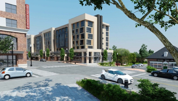
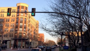
This is particularly true along West Broad Street (Route 7), which has historically served as the City’s major office and retail thoroughfare. Broad Street is also a heavily-traveled commuter corridor with a physical design that can inhibit pedestrian and bicycle mobility. Moreover, redevelopment efforts have, at times, been fragmented, failing to connect the established residential neighborhoods on both sides of the street.

To help provide a conceptual framework for public improvements and a catalyst for new growth, the City Council unanimously adopted the West Broad Street Small Area Plan on April 11, 2016. The West Broad Street Plan follows more than a year of review and provides a refined redevelopment vision for Broad Street between the 300 block of Little Falls Street and the 11000 block of Broad Street.

Developed in accordance with the City’s adopted Comprehensive Plan, the West Broad Street Plan is intended to serve as a reference for property owners and developers as they contemplate redevelopment. It provides policy recommendations on matters such as land use, zoning, mobility and accessibility, innovative and appropriate building design, and the environment. The West Broad Street Plan also encourages the development of activity nodes at key intersections and identifies short-term public improvements the City can make to meet long-term goals (e.g., sidewalk and crosswalk improvements, wayfinding signage, and bicycle parking).

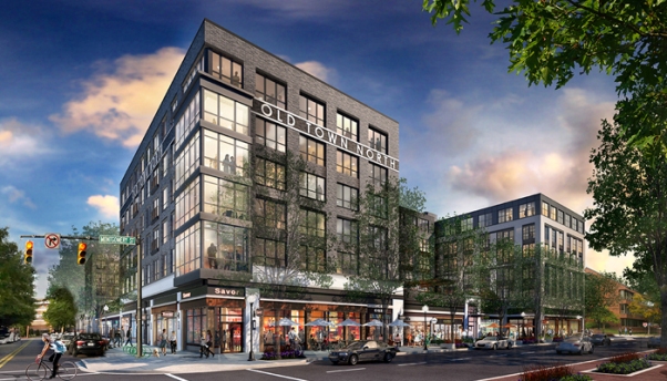
The City Council’s adoption of the West Broad Street Plan follows approval of three other small area plans in recent years, including the North Washington Street Small Area Plan (adopted in June 2012), the South Washington Street Small Area Plan (adopted in October 2013), and the Downtown/City Center Small Area Plan (adopted in June 2014). While none of these small area plans technically amend the City’s adopted Comprehensive Plan, Future Land Use Map, Zoning Ordinance, or Zoning Map, they are intended to provide supplemental, focused policy guidance for relatively small sections of the City.

Interestingly, the West Broad Street Plan’s initial draft text suggested height limitations and potential layouts for new structures. Some property owners expressed concerns that inclusion of such recommendations would constrain new investment and redevelopment. In response, staff revised the plan to deemphasize height and density, and to state that such issues would be reviewed and negotiated in the context of individual legislative applications.

It is hoped the West Broad Street Plan will help the City transform Broad Street from a commuter corridor into a vibrant, walkable, and economically viable destination that reinforces the City’s well-established unique small businesses. Staff estimates that, depending on the scale of redevelopment achieved at full build-out, redevelopment of the remaining underdeveloped parcels along West Broad Street area could yield between $5.9 million and $14.2 million annually in tax revenue.

Additional information may be found on the City’s West Broad Street Plan website.

Building Height Measurement Redefined by Stafford

Illustrative Drawing
Source: staffordcountyva.gov

On April 19, the Stafford County Board of Supervisors unanimously approved a zoning text amendment that redefined how Stafford County measures building height. Prior to this amendment, the method the Virginia Uniform Statewide Building Code (VUSBC) used to measure building height differed from the County’s Zoning Ordinance.

The conflict between the two Codes stemmed from a discrepancy in which elevation points around the structure to utilize when measuring the difference between the ground level and the roof elevation. The discrepancy led to situations where, for example, builders of houses on sloped lots with walk-out basements would have had to lower the height of the houses to comply with the Zoning Ordinance.

Illustrative Drawing
Source: staffordcountyva.gov


The image above demonstrates the old method for determining building height, which used the average of the grade at 20 feet from the structure.

The adopted Zoning Ordinance now reads:

(2) Height of structure. The vertical dimension of a structure as measured from the average elevation of the finished grade at the front line of the building to the highest point of the roof of a flat roof, the deck line of a mansard roof, or the mean height level between eaves and ridge (mid-line of the roof) for a gable, hip or gambrel roof. The height limitations contained in Table 3.1 shall not apply to spires, belfries, cupolas, antennas, communication towers, silos, barns, water towers, ventilators, chimneys, monuments, flag poles or other appurtenances usually required to be placed above the roof level and not intended for human occupancy.

The image below illustrates the new method for measuring height (from the front of the building only.)

Illustrative Drawing
Source: staffordcountyva.gov


The approved Zoning Ordinance is more consistent with the VUSBC and the means of measuring building height employed in other jurisdictions.  This should allow homebuilders and other developers to proceed with designs that are consistent with their models in other jurisdictions. To read the adopted ordinance, click here.