On February 18, 2023, the Arlington County Board approved Orr Partners’ 4.1 site plan providing for the redevelopment of the aging 0.74-acre Joyce Motors building and property in central Clarendon. The site contains a surface parking lot and the circa 1950 Joyce Motors building, which is considered a prime example of the “Streamline Moderne” architectural style popular in the 1940s and 1950s.
Following on the heels of the County Board’s adoption of the updated Clarendon Sector Plan, the proposed redevelopment includes a mixed-use residential building containing up to 241 residential units, a maximum of 186,254 square feet of residential GFA, and a maximum of 3,825 square feet of ground floor retail GFA.
A key component of the project is the incorporation of the most historic and salvageable portions of the Joyce Motors building façade into the new building’s architecture, in accordance with the Sector Plan’s recommendations.
For more than a year prior to the submission of the site plan application, the development team worked with the County’s Historic Preservation Program staff to determine the most pragmatic preservation approach, recognizing the reality of the condition of the building and its materials.
As a result, the building’s exterior enamel panels will be removed and sent to a historic preservation lab for restoration to their original condition. They will subsequently be reinstalled at the most visually-prominent corner of the site, where the reconstructed façade will serve as the architectural focus of the new building and provide the public direct access to this resource. The project also includes a $25,000 contribution towards tan onsite interpretive commemoration of the Joyce Motors building.
Another historic preservation aspect of the project includes the permanent preservation of the circa 1939 Clarendon Barbershop Building, located at 1407 N. Garfield Street through the use of the County’s Transfer of Development Rights program. Preservation of this resource is specifically recommended under the Sector Plan, and the transfer of density to the Joyce Motors site will require the recordation of a historic preservation easement over the Barbershop Building.
The proposed building will be designed at the LEED Gold level and, while the project is subject to the previous version of the County’s Green Building Incentive Policy, Orr Partners is committed to achieving many of the baseline prerequisites of the current Green Building policy to align with the goals and objectives of the Community Energy Plan. In response to SPRC and community comments, enhanced landscaping will also be provided at the street level along N. Irving Street, as well as in a second-level courtyard and on a 10th-floor terrace.
In terms of transportation, the project will provide significant sidewalk upgrades around the site, bicycle facilities, and curb extensions for safer pedestrian crossings. It will also provide segments of two new streets contemplated under the Sector Plan’s grid network, including a portion of the planned 10th Road North. The project will additionally make a $400,000 contribution towards offsite transportation improvements, which may be allocated towards enhanced bicycle facilities along 10th Street N.
Housing affordability figured prominently into the project, and the project will provide nine onsite Committed Affordable Units as well as an affordable housing contribution. Importantly, Orr Partners recognized the County’s need for large affordable units and has subsequently agreed to provide two three-bedroom apartments as part of their none onsite affordable units. The project will also provide a $557,143 contribution towards public open spaces in the vicinity of the project.
The proposed project will honor the Joyce Motor’s building’s heritage, enhance Clarendon’s neighborhood character, and achieve the Clarendon Sector Plan’s land use, density, height, and housing diversity goals.
Walsh Colucci shareholders Andrew Painter and Nicholas Cumings assisted Orr Partners throughout the process, with Andrew providing the presentation at the County Board.
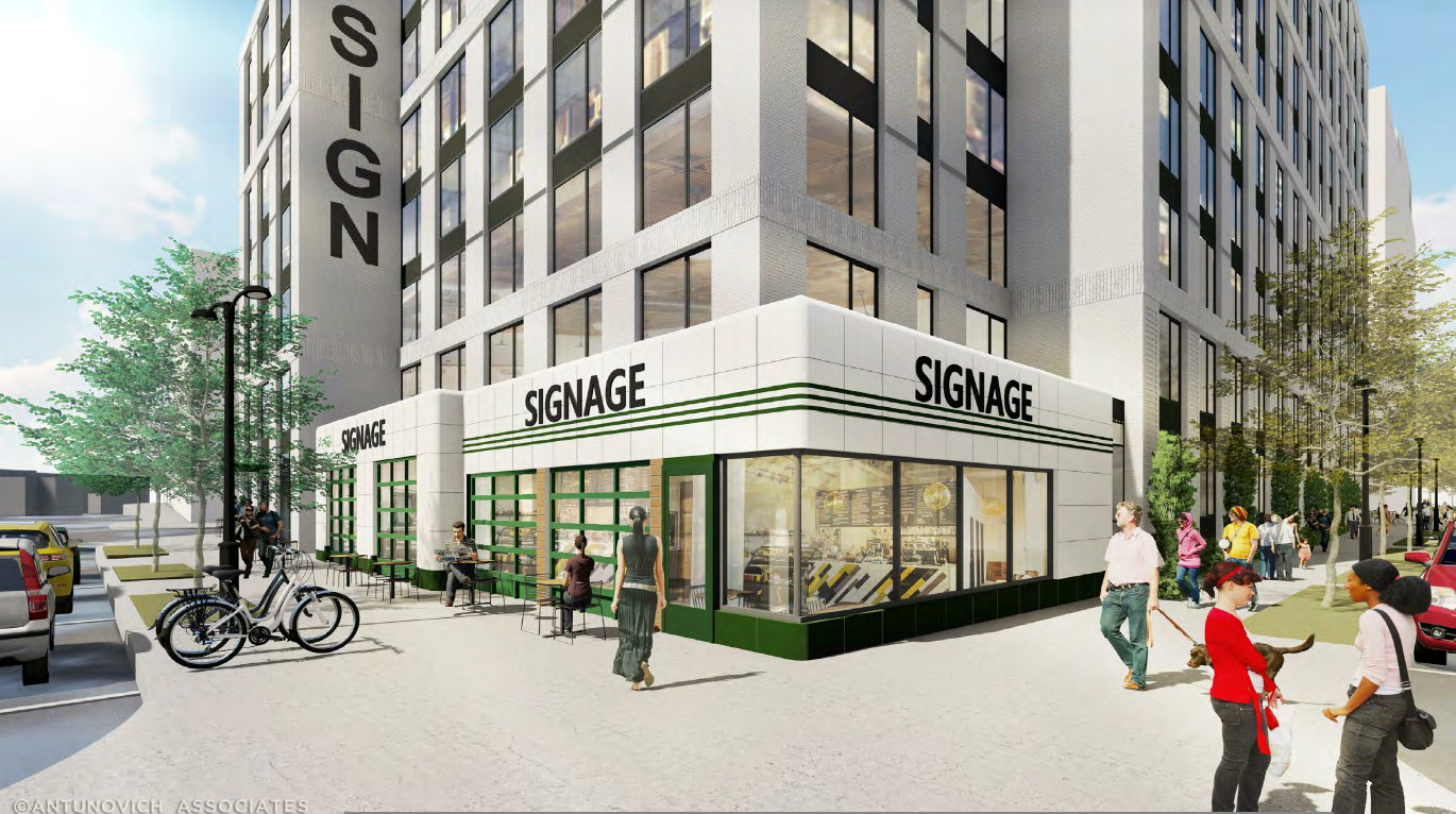
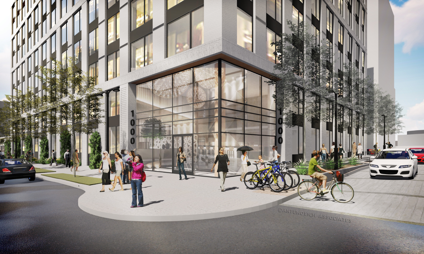
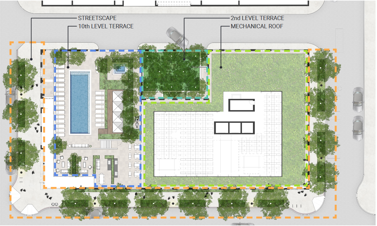


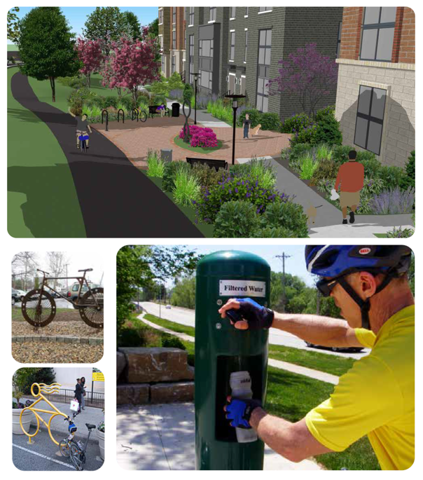
 Image Source: Stanly Martin Companies
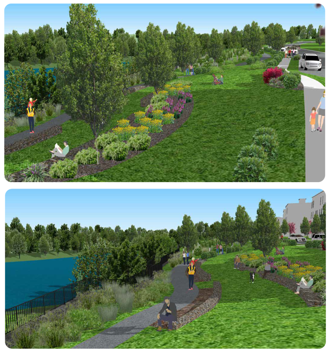